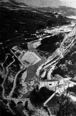
| Název: Name: | Fort Rocchetta | Fort Rocchetta |
| Originální název: Original Name: | Straßensperre Rocchetta | |
| Další názvy: Other Names: | - | |
| Obec: Municipality: | Ton | Ton |
| GPS souřadnice: GPS Coordinates: | 46°13'57.40"N 11°03'49.93"E | |
| Fotografie nebo nákres: Photo or Sketch: | | |
| Druh objektu: Sort of Object: | uzávěrový fort | Barrier Fort |
| Typ objektu: Type of Object: | silniční uzávěr | Road Barrier |
| Vyšší pevnostní celek: Upper Fortress Complex: | Pevnostní uzávěr Nonstal | Fortress Barrier Nonstal |
| Zahájení stavby: Start of Construction: | DD.MM.1860 | |
| Dokončení stavby: Completion of Construction: | DD.MM.1864 | |
| Výzbroj: Armament: | 11x 12cm kanon M-61 | 11x 12cm Cannon M-61 |
| Posádka: Crew: | ? | |
| Bojové využití: Combat Use: | DD.MM.RRRR-DD.MM.1866 | DD.MM.RRRR-DD.MM.1866 |
| Současný stav: Current Condition: | nepatrné zbytky | small relics |
| Přístupnost: Accessibility: | zaniklý | defunct |
| Poznámka: Note: | Roku 1922 zničena výbuchem uskladněné munice. | In 1922, destroyed by an explosion of stored ammunition. |
| Zdroje: Sources: | www.trentinograndeguerra.it | |
